


Maps for municipalities and destinations
A tourist map, info boards, printed maps and an interactive map from a single source.
For municipalities, tourist boards and local action groups (LAGs) we deliver the whole project: a new panoramic map, info boards with stands at entry points, tear-off pads and folded maps for the tourist office, and an interactive map for your website. One map ties all the products together, so the destination looks the same everywhere.
We have been drawing panoramic maps for Slovenian municipalities since 1991: more than 150 maps for more than 100 municipalities and destinations, and more than 170 info boards installed.
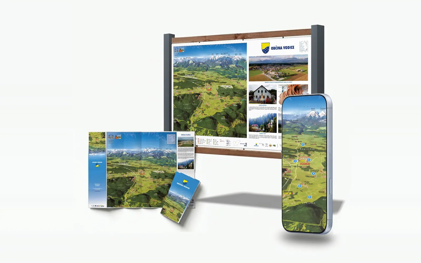
What you can order
Order the products one by one or all together as one project.
How a project works
From the first conversation to a board in the field and a map on the web.
- 1Conversation and quoteTogether we define the area, the viewpoint and the products you need.
- 2The mapWe prepare a sketch, draw the map by hand, add the trails and prepare the legend.
- 3Boards and printWe place the map on boards, tear-off pads or folded maps, handle printing and install the stands. The client prepares the foundations.
- 4Interactive mapThe same map goes live on the web. We add and update the content ourselves and usually make changes the same day.
Once it is clear what you want on the map, it is ready in about a month.
Co-funded projects
LAGs, Interreg, the Recovery and Resilience Plan and ministry calls.
Our maps, boards and interactive maps have been made in LAG projects, Interreg programmes, the Recovery and Resilience Plan (NOO) and calls by the Ministry of the Economy. In co-funded projects we work either as the contractor for part of the project or as lead partner.
When one or more municipalities prepare an application, we provide:
- an itemised quote: map, boards, stands, printed materials, interactive map,
- a short product description for the application form,
- visualisations: a board at the chosen location, a tear-off pad or folded map, and the interactive map on a phone.
Content from the board and tear-off pad is extended in the interactive map, reached through a QR code. When the local offer changes, there is no need to reprint the whole run.
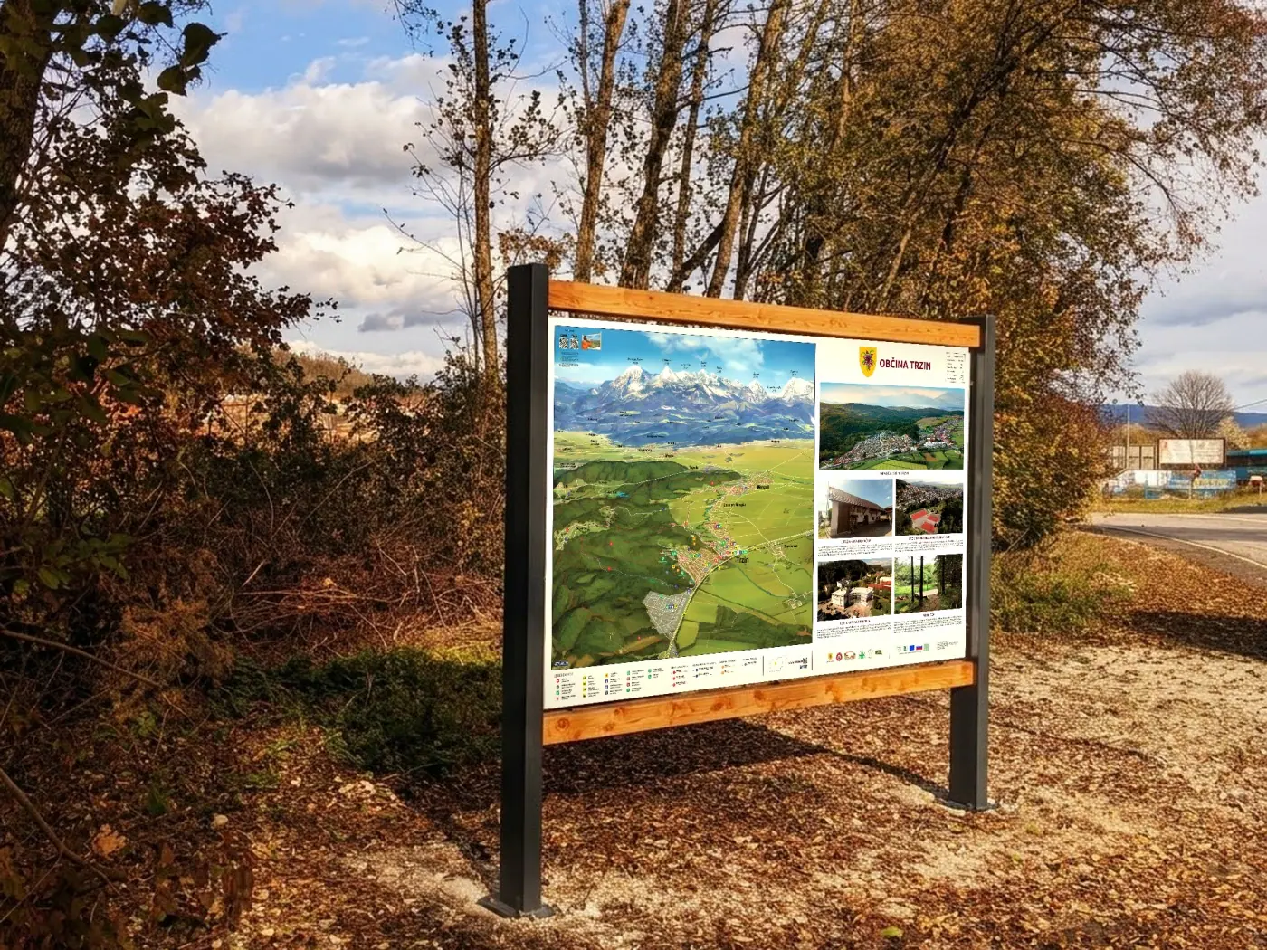
- LAG (LEADER)
- LAG Za mesto in vas (2021, 2023), Šmarješke Toplice (2019), Bela krajina (2020–2021), Sevnica (2011)
- Interreg
- Jesenice: Slovenia–Austria (2018) and Slovenia–Italy (2020), Sevnica: Slovenia–Croatia (2023)
- Recovery and Resilience Plan (NOO)
- Ravne na Koroškem (2025)
- Ministry of the Economy
- Upper Savinja Valley (2018–2019)
- Other EU projects
- Krško (2020), Gornja Radgona (2020)
“Modern, attractive and durable panoramic information boards … will make the local offer more visible.”
Examples
A selection of projects for municipalities and local action groups.
- LAG Za mesto in vas21 info boards in four municipalities, folded maps and an updated interactive map.
- PohorjeA new map of Pohorje and 14 info boards.
- MozirjeA board at the tourist office and the municipal map on three boards.
- Ribnica na PohorjuA new map, tear-off pad and interactive map.
- ŠenčurTwo info boards with stands.
Frequently asked questions
Who makes tourist maps for municipalities in Slovenia?
Panorama from Lesce has been drawing panoramic and tourist maps for Slovenian municipalities and destinations since 1991. We deliver the map, boards, printed materials and interactive map in one project.
How long does it take to make a map?
Once it is clear what you want on the map, it is ready in about a month. Boards and printed materials follow; the overall timeline depends on preparing the content and the foundations for the stands.
Do you prepare a quote and visualisations for funding applications?
Yes. For LAG, Interreg, NOO and other calls we prepare an itemised quote, a product description and visualisations of the board, tear-off pad or interactive map that you can attach to the application.
Can a project cover several municipalities?
Yes. In the LAG Za mesto in vas project we drew five maps in a shared style for five municipalities and then installed 21 info boards.
How much does a map for a municipality cost?
The price depends on the size of the area, the content on the map and the products you need. Send us the area and your wishes and we will prepare a quote.
Can the map be updated later?
Yes. We add new trails, services or sights to the map and prepare a reprint or a new board.
