


April 2026
Ribnica na Pohorju
Panoramic mapPrint
A new panoramic map of the Ribnica Pohorje
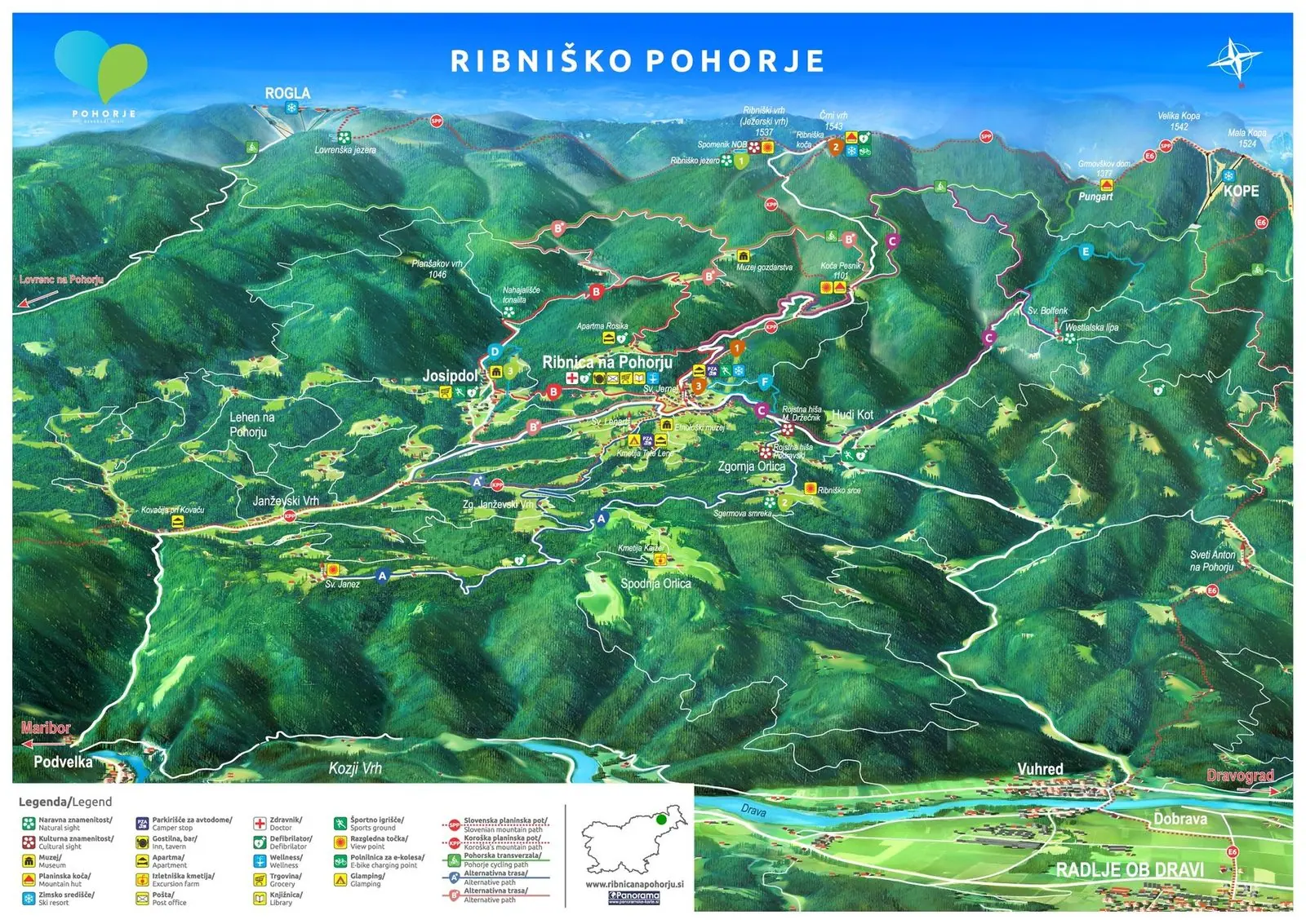
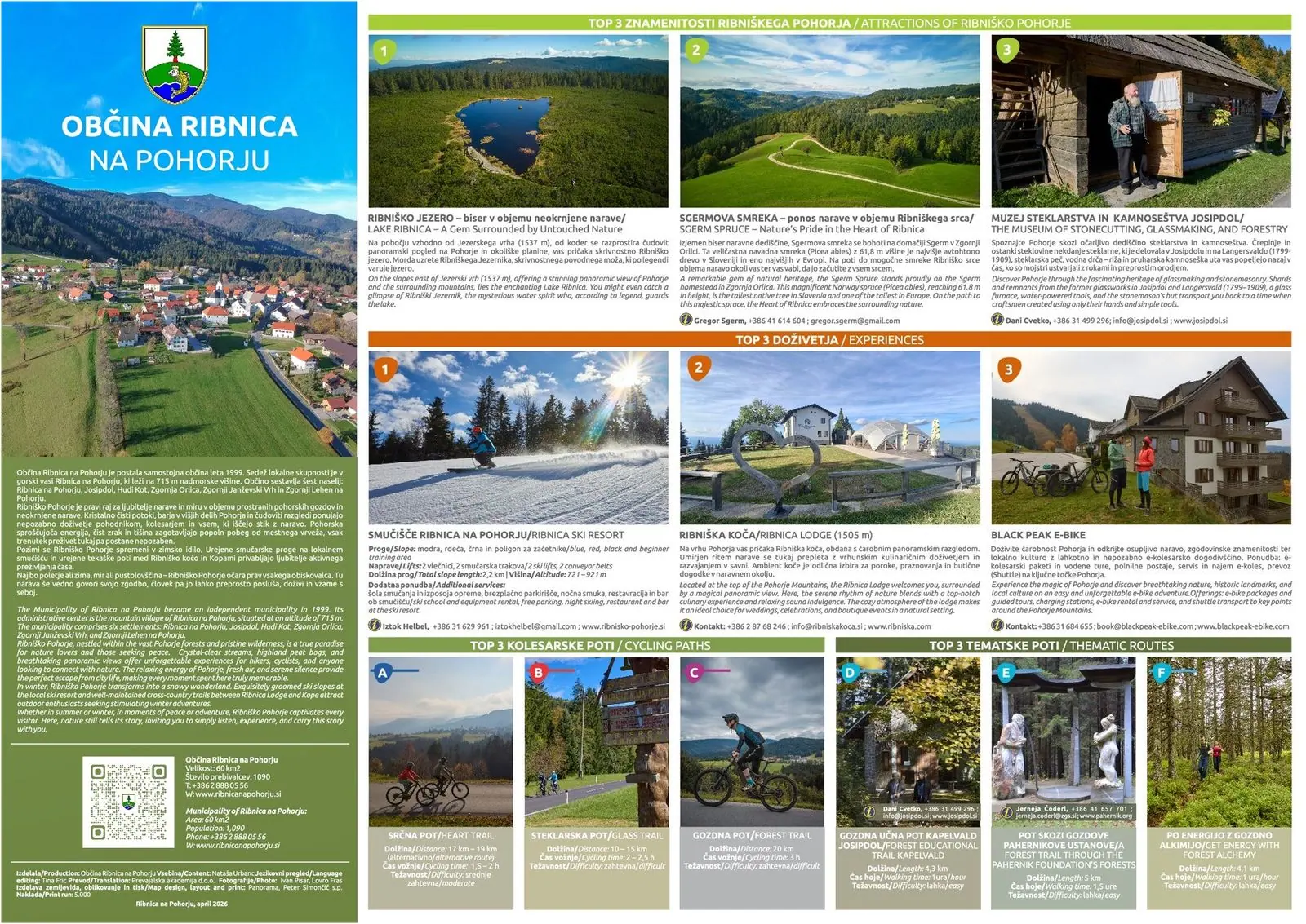
For the Municipality of Ribnica na Pohorju we drew a new panoramic map of Ribniško Pohorje and printed it as an A3 map with photos and descriptions on the back.
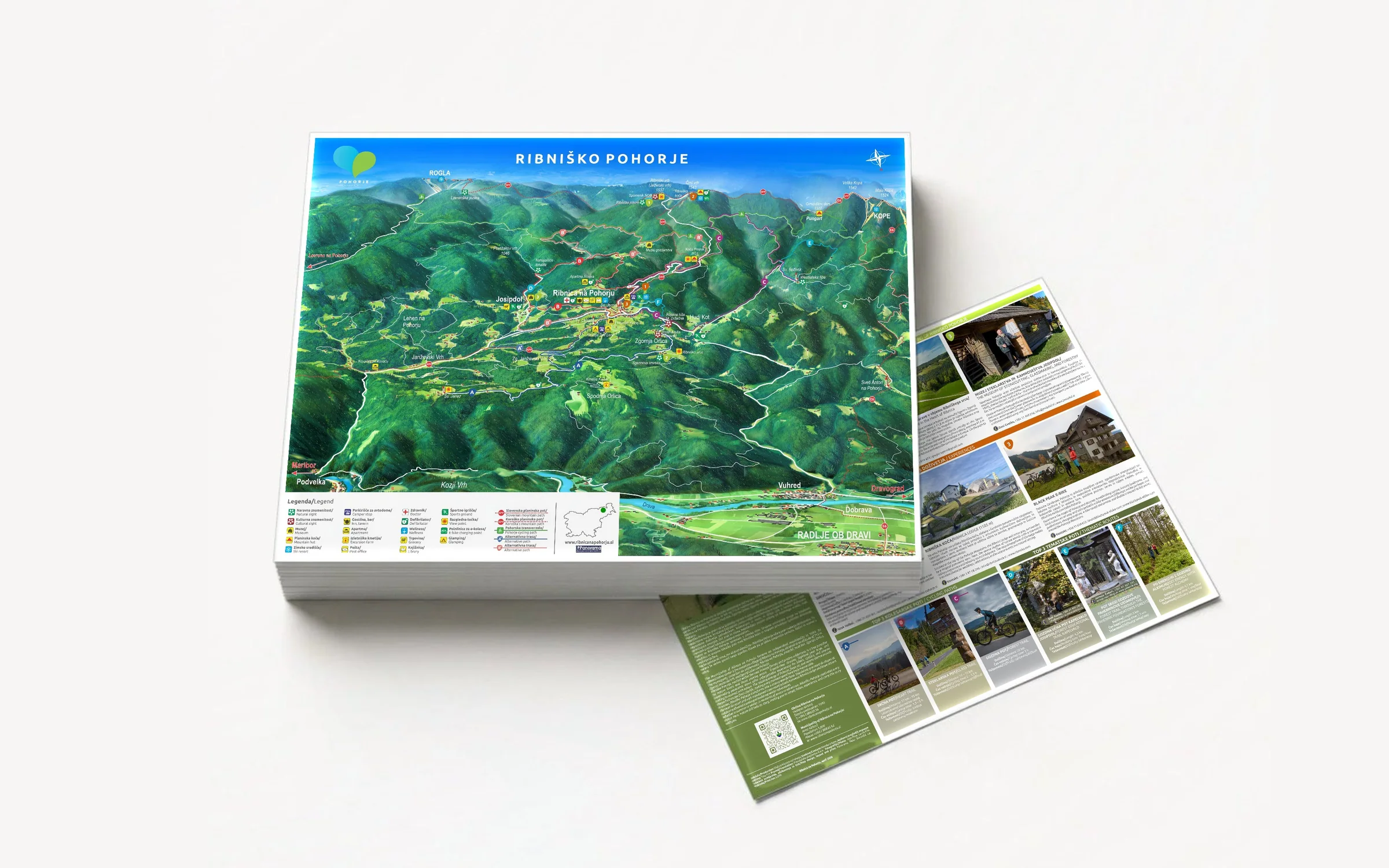
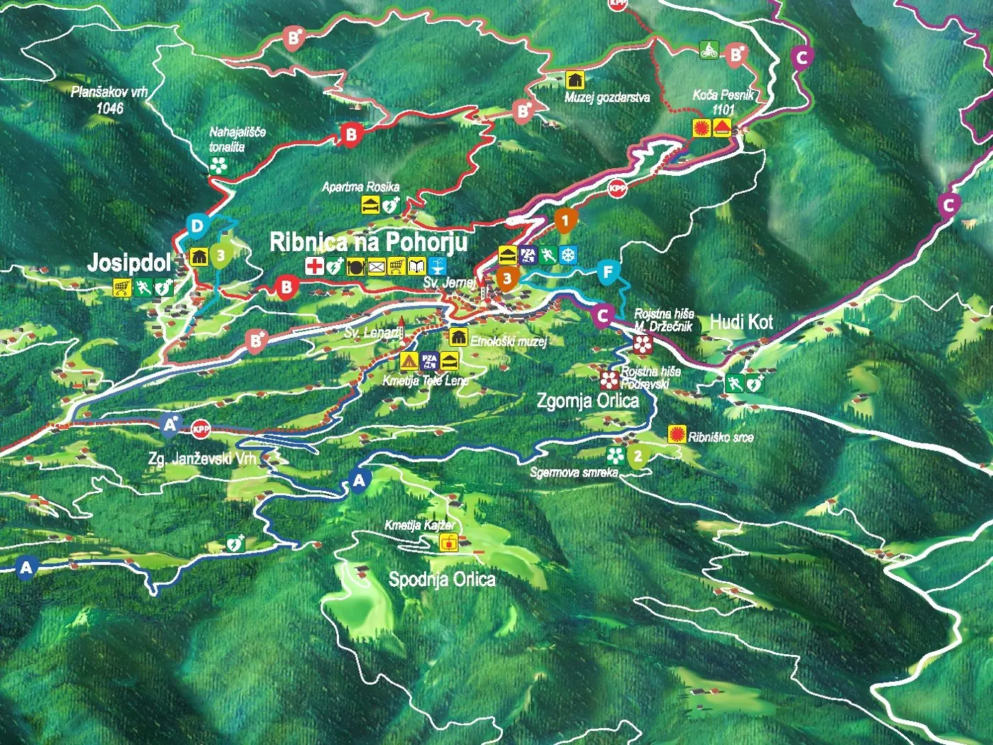
The map is drawn from a digital elevation model and then finished by hand. It shows the municipality and its surroundings, from Josipdol and Hudi Kot to Orlica, with roads, villages and peaks, hiking and cycling routes, and places to eat and stay.
The back carries photos and texts about the municipality, its sights and trips.
The same map is the basis of the Ribnica na Pohorju interactive map, which we are now building on the Pan map server.
Gallery
Interested in a similar project?
Send us a short description and we will prepare a proposal and a quote.
